01
— Calgarywith Jonas Laurent Henderson
Software
3 tools
Photoshop · Illustrator · InDesign
2 plates
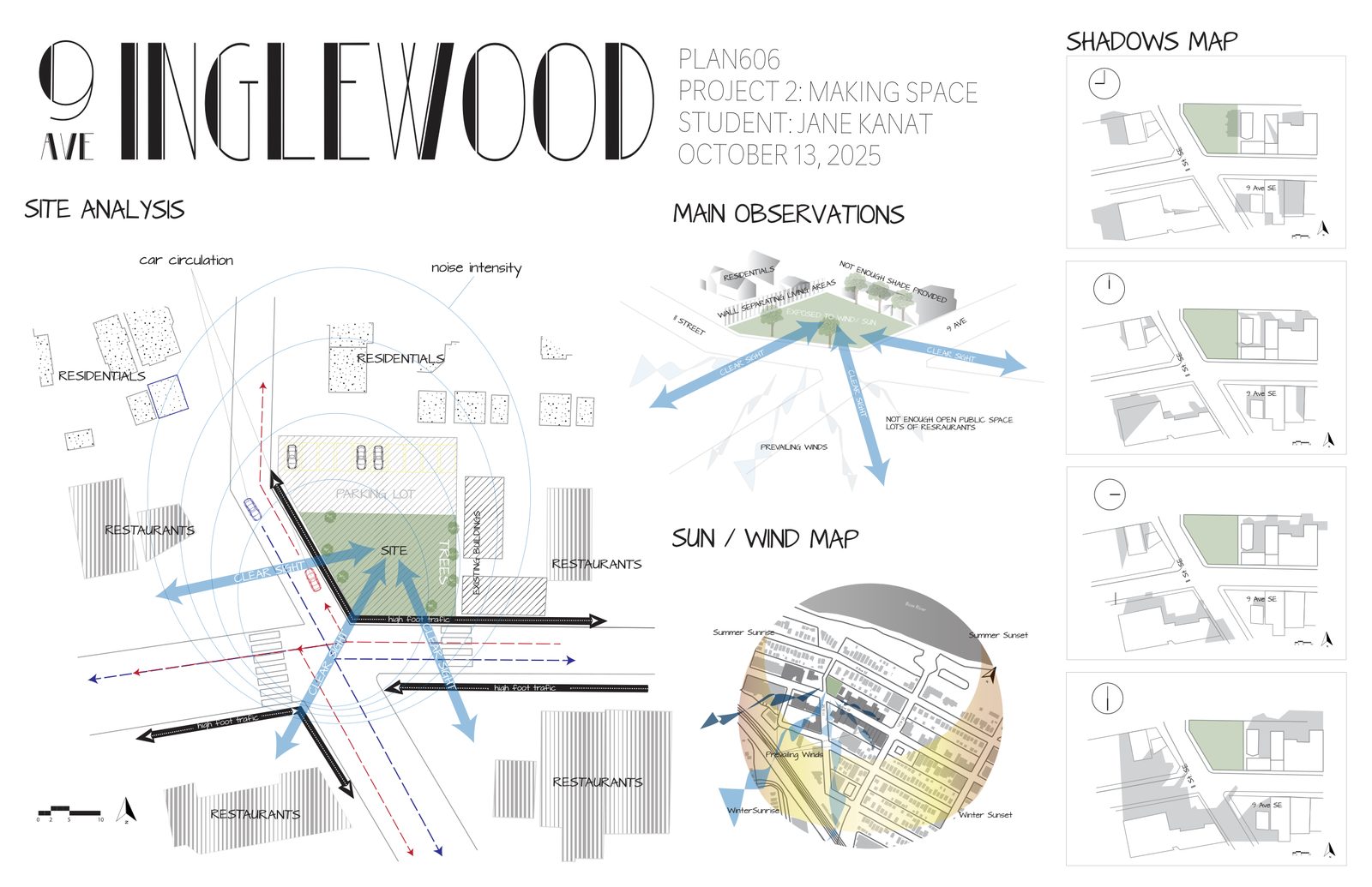
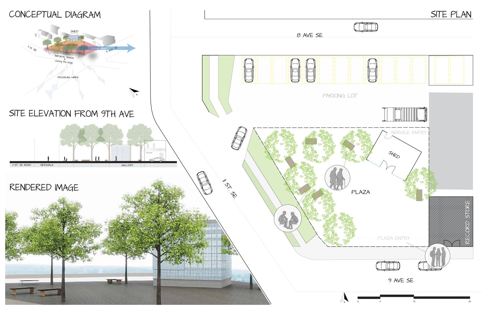
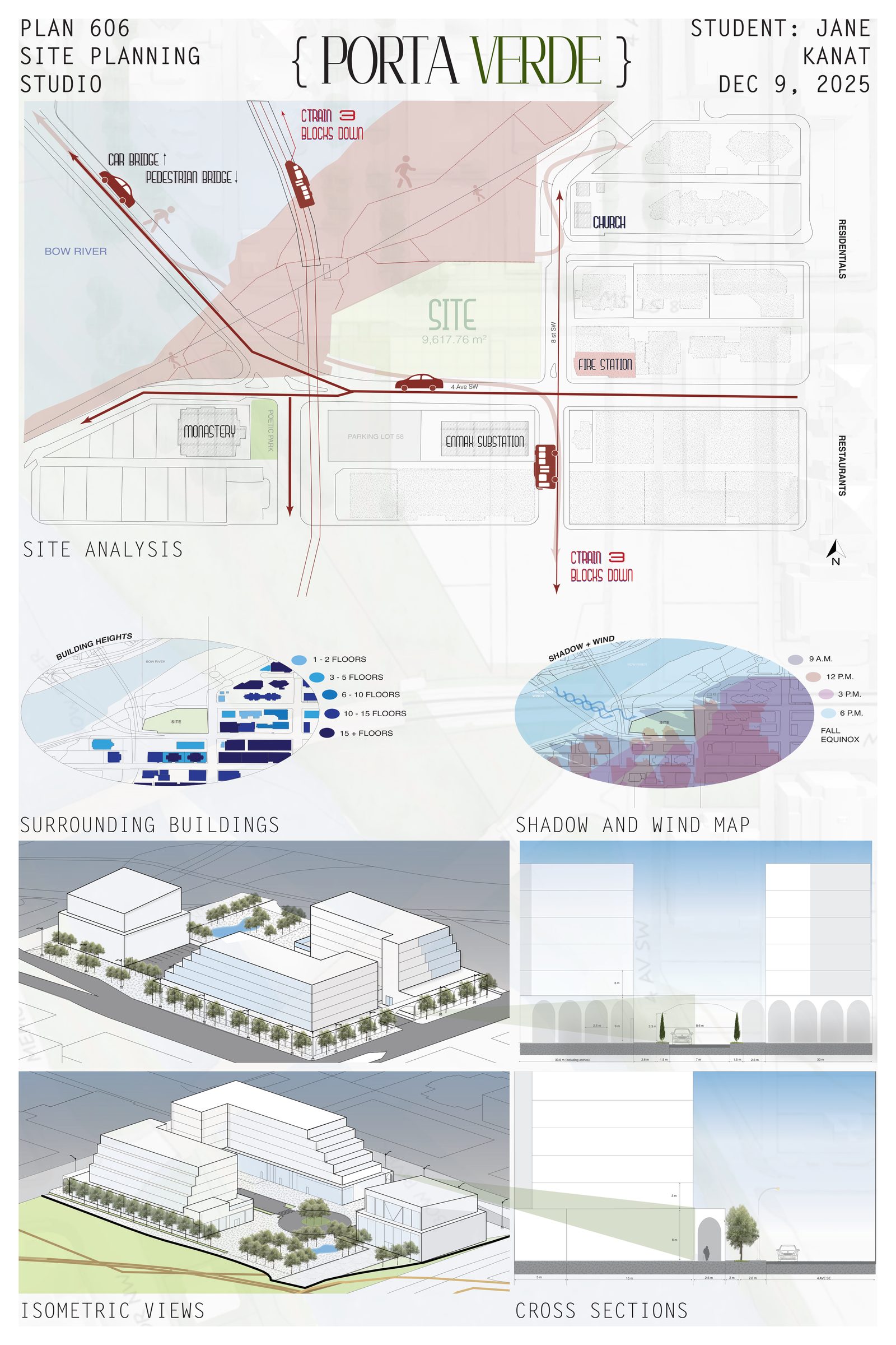
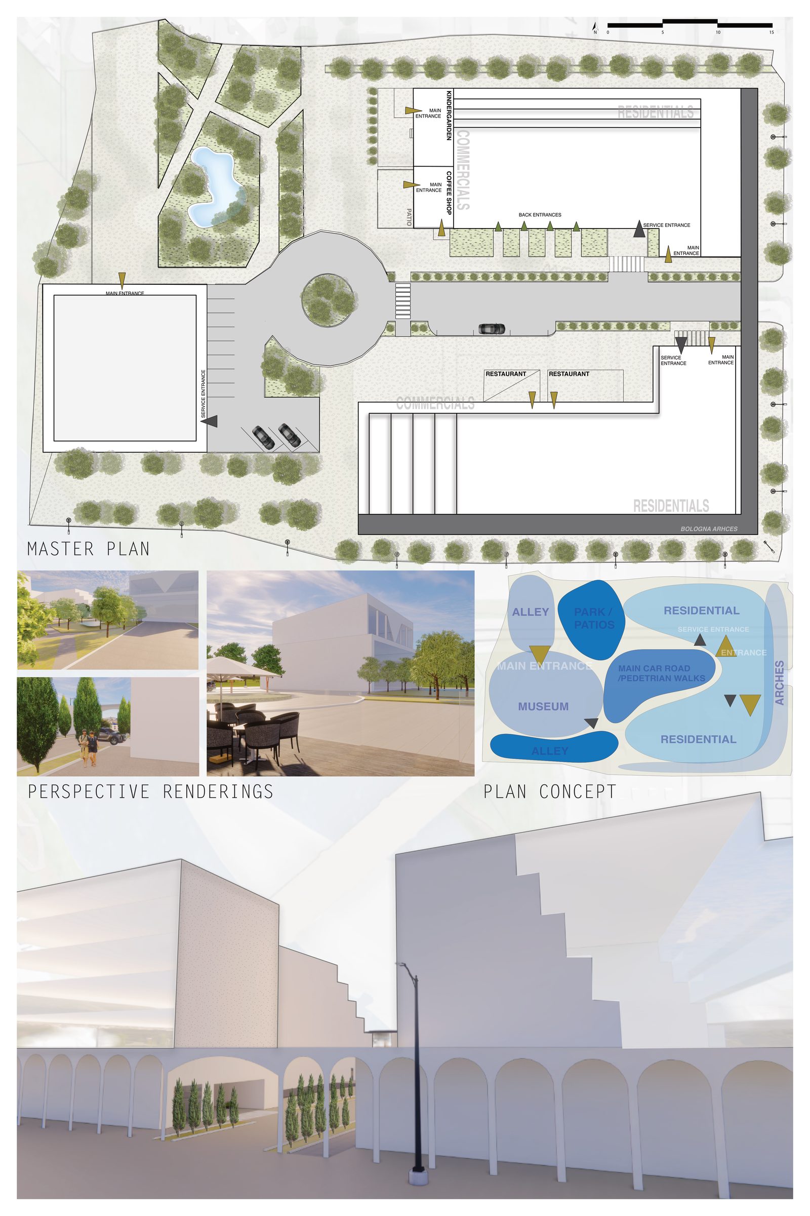
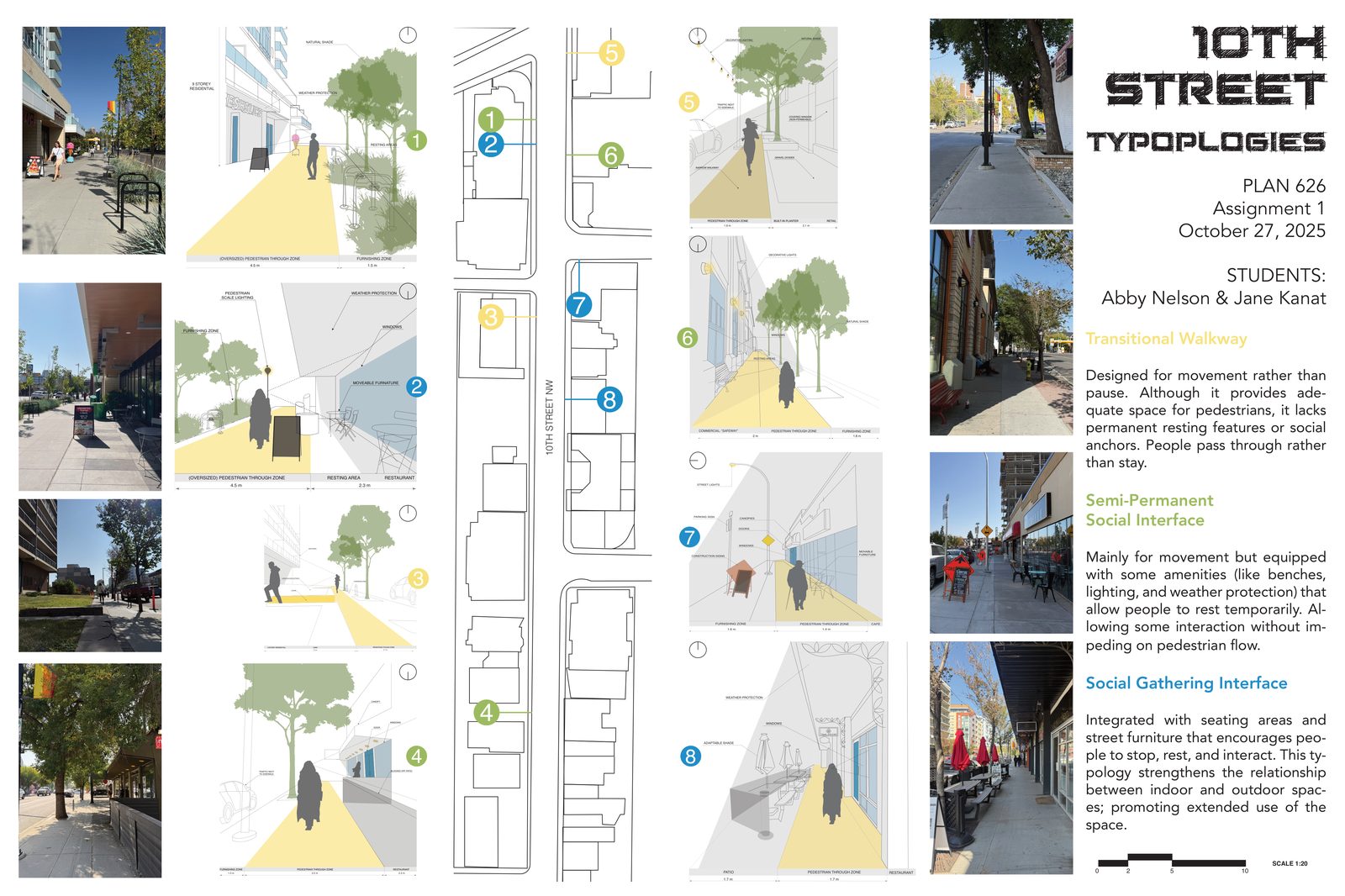
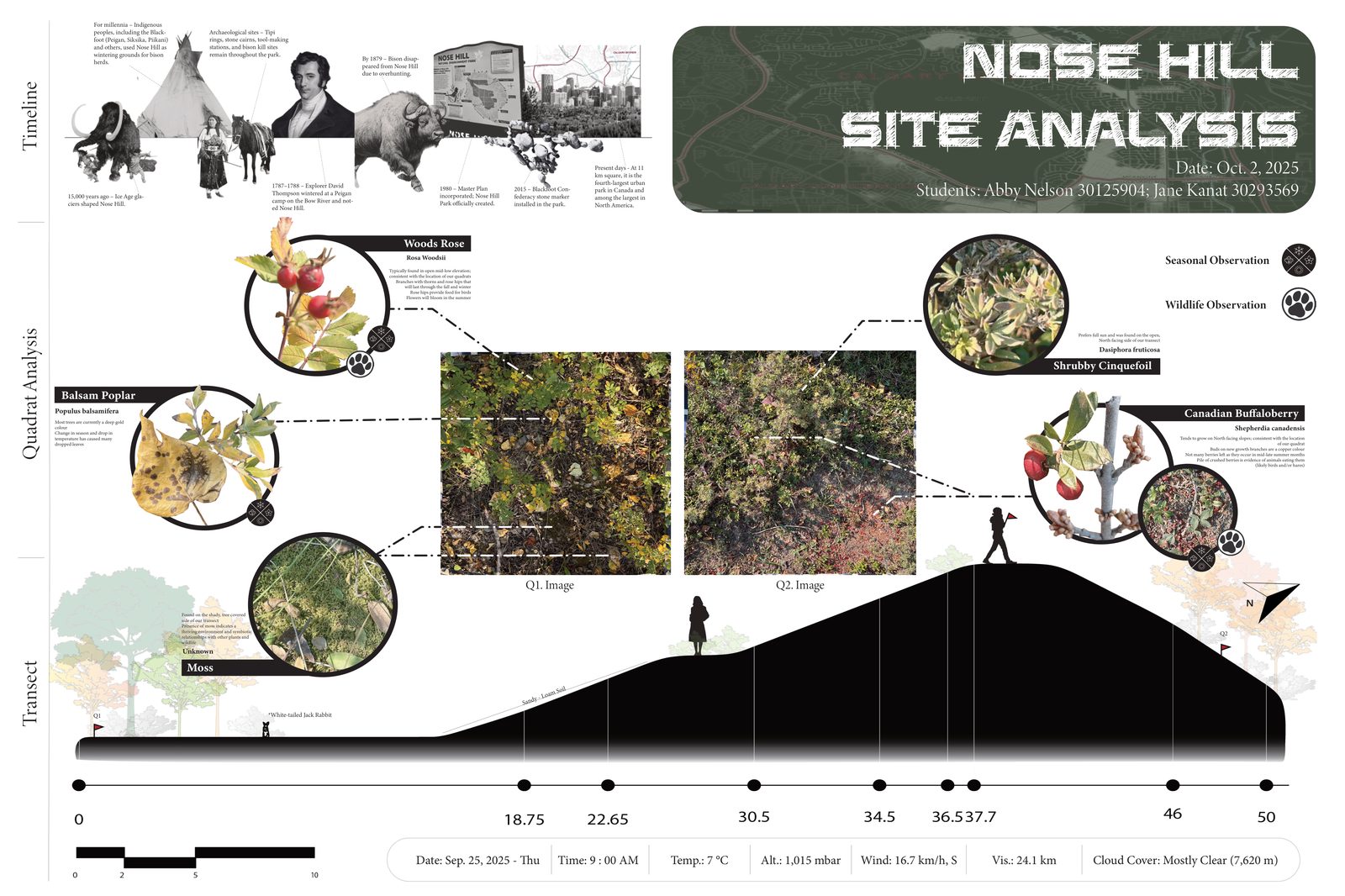
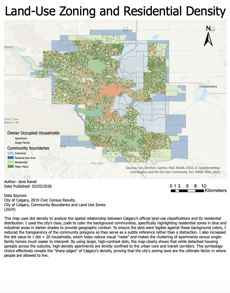
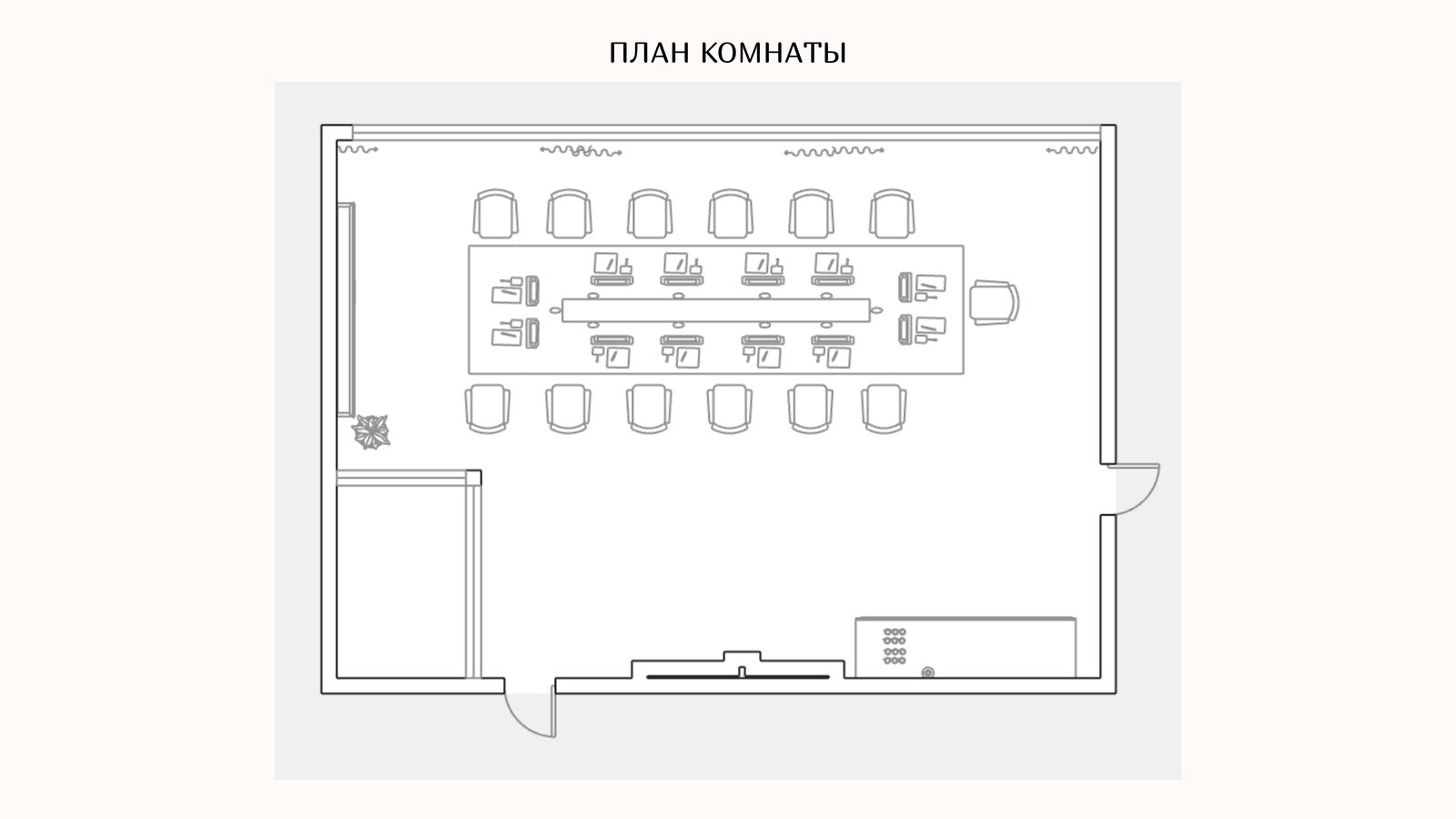
Urban site analysis of the Montgomery district in Calgary focusing on spatial structure, pedestrian conditions, historical development and environmental factors such as sun paths and wind patterns. The study includes permeability mapping, street observations, section drawings, signage analysis, figure-ground and asphalt mapping, as well as pedestrian-satisfaction mapping to understand how the area functions and how people interact with the urban environment.
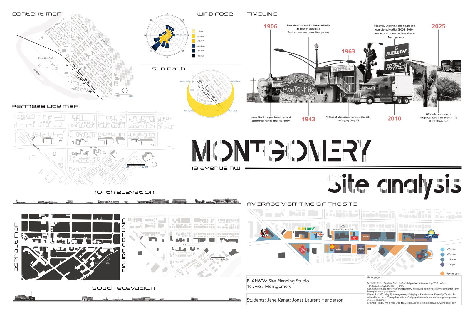
Plate 01
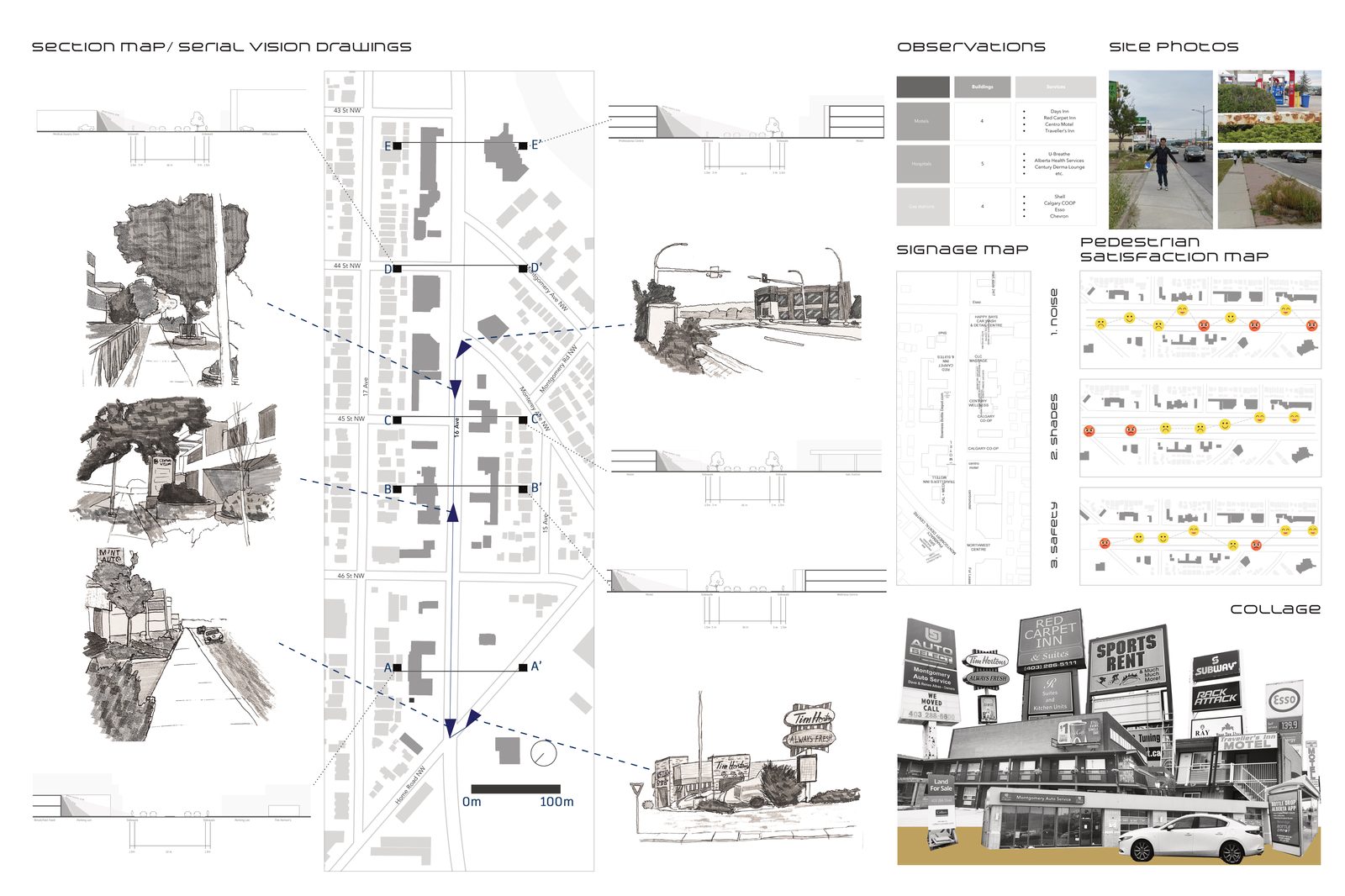
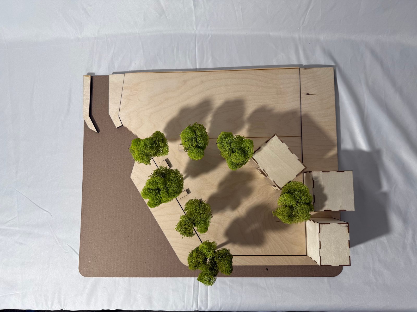
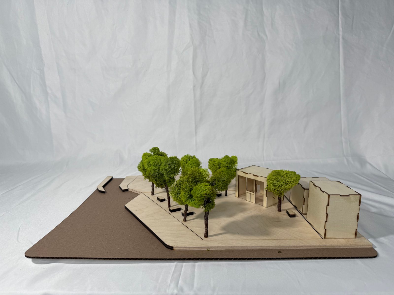
Plate 02